Briefing
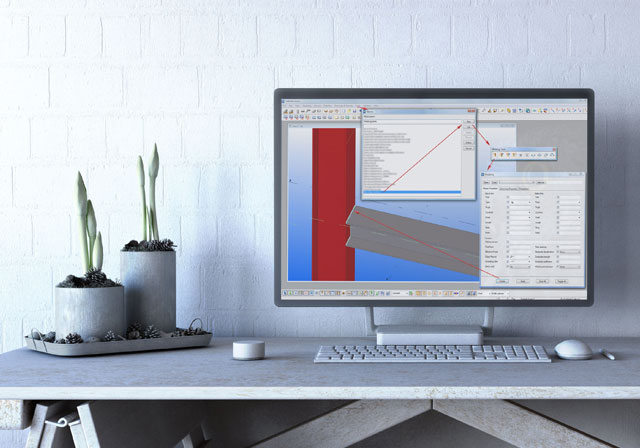
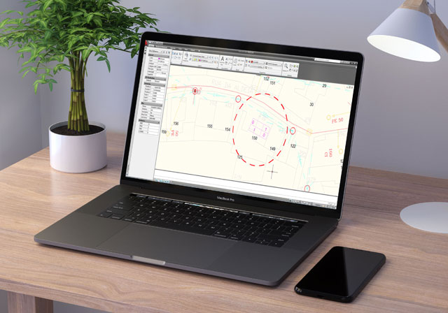
This software was developed in order to automate the process of inserting designed blocks (with data extracted from external databases) in extensive cartography Cad.
For its development, we had to rely on the team work routines and different attempts to optimize the management information in Excel.
Before...
- After working in the field, the information was exported to Excel;
- Manually create CAD blocks;
- Enter coordinates manually;
- Place each point on the right coordenate;
- Need for technical specialists;
- Process extremely time consumer;
- Unproductive, taking too long to those involved;
- A plant comes to take two weeks to be made;
- After done, there was always errors that were almost impossible to detect;
After...
- Automate the process;
- Now the team just have to open the application, press four buttons and select the files to fill particular plant;
- That said, the mapping is automatically generated.
And the benefits?
- Increased productivity;
- Freed the workers to other tasks;
- Reduces costs;
- It went to take two weeks to take only a few minutes;
- Intuitive and simple;
- Lets you open / save in DXF or DWG;
- Allows you to edit and manipulate the file;


[tagcloud]